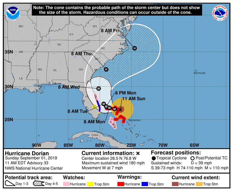
DORIAN BECOMES THE STRONGEST HURRICANE IN MODERN RECORDS FOR THE
NORTHWESTERN BAHAMAS. …CATASTROPHIC CONDITIONS OCCURRING IN THE
ABACOS ISLANDS**
NEW INFORMATION
—————
Tropical storm watch
– A Tropical Storm Watch has been issued for Highlands and Polk
Flood Advisory
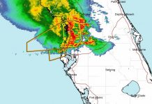
A flood advisory has been issued for parts of Citrus County
Storm information:
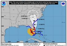
– About 300 miles east of Sebring FL or about 325 miles east of Winter Haven FL
– 26.5N 76.8W
– Storm Intensity 180 mph
– Movement West or 270 degrees at 7 mph
Flood information:
The National Weather Service has issued a Flood Warning for the following rivers;
- Withlacoochee At Holder
- Peace River At Bartow
The warning will remain in place until Thursday evening.
According to the NWS, recent rainfall atop saturated soils due to rainfall over the past several weeks has resulted in the Withlacoochee River at Holder to rise into flood stage. Levels will continue to be monitored for any impacts from additional rainfall.
The Withlacoochee At Holder and the Peace River At Bartow continue to remain in flood stage due to recent heavy rain. Water levels are expected to remain fairly constant for the next couple days.
However, as Dorian approaches the coast, water levels could rise once more.
The river is forecast to rise above flood stage by this afternoon and continue to rise to near 8.1 feet by tomorrow morning. The river is expected to fall below flood stage by Thursday evening.
- At 09 a.m Sunday the stage was 8.1 feet.
- Minor flooding is occurring and Minor flooding is forecast.
- Flood stage is 8.0 feet.
- Impact…at 9.0 feet…Arrowhead subdivision floods with water in homes.
- Impact…at 8.0 feet…Water approaches house foundations in Arrowhead subdivision.
This compares to a previous crest of 8.2 feet on Oct 1, 1988.
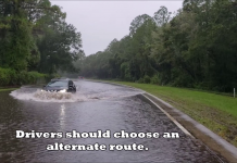
Do not drive cars through flooded areas.
SITUATION OVERVIEW
——————
Major Hurricane Dorian is forecast to drift west through the northwest Bahamas and then turn north along the Florida east coast over the next few days. At this time the primary concern is for tropical-storm-force winds over Highlands and eastern portions of Polk county.
POTENTIAL IMPACTS
—————–
* WIND:
Prepare for dangerous wind having possible significant impacts across eastern Polk County and Highlands County.
Potential impacts in this area include:
– Some damage to roofing and siding materials, along with damage to porches, awnings, carports, and sheds. A few buildings experiencing window, door, and garage door failures. Mobile homes damaged, especially if unanchored. Unsecured lightweight objects become dangerous projectiles.
– Several large trees snapped or uprooted, but with greater numbers in places where trees are shallow-rooted. Several fences and roadway signs blown over.
– Some roads impassable from large debris, and more within urban or heavily wooded places. A few bridges, causeways, and access routes impassable.
– Scattered power and communications outages, but more prevalent in areas with above-ground lines. Also, prepare for the hazardous wind having possible limited impacts across the rest of west-central and southwest Florida.
* FLOODING RAIN:
Prepare for locally hazardous rainfall flooding having possible limited impacts across west-central and southwest Florida.
Potential impacts include:
– Localized rainfall flooding may prompt a few evacuations.
– Rivers and tributaries may quickly rise with swifter currents. Small streams, creeks, canals, and ditches may become swollen and overflow in spots.
– Floodwaters can enter a few structures, especially in usually vulnerable spots. A few places where rapid ponding of water occurs at underpasses, low-lying spots, and poor drainage areas. Several storm drains and retention ponds become near-full and begin to overflow. Some brief road and bridge closures.
PRECAUTIONARY/PREPAREDNESS ACTIONS
———————————-
* EVACUATIONS:
Listen for recommended preparedness actions. For those not under evacuation orders, assess the risk from wind, falling trees, and flooding at your location. If you decide to move, relocate to a safer location nearby. If you do not relocate, help keep roadways open for those under evacuation orders.
* OTHER PREPAREDNESS INFORMATION:
Now is the time to check your emergency plan and emergency supplies kit and take necessary actions to protect your family and secure your home or business.
When making safety and preparedness decisions, do not focus on the exact forecast track since hazards such as flooding rain, damaging wind gusts, storm surge, and tornadoes extend well away from the center of the storm. If in a place that is vulnerable to high wind, such as near large trees, a manufactured home, upper floors of a high-rise building, or on a boat, plan to move to safe shelter. If you live in a place particularly vulnerable to flooding, such as near the ocean or a large inland lake, in a low-lying or poor drainage area, or near an already swollen river, plan to move to safe shelter on higher ground.
Always heed the advice of local officials and comply with orders that are issued. Do not needlessly jeopardize your life or the lives of others.
When securing your property, outside preparations should be concluded as soon as possible before conditions deteriorate.
The onset of strong gusty winds or flooding can cause certain preparedness activities to become unsafe. Be sure to let friends and family members know of your intentions for weathering the storm and your whereabouts. Have someone located away from the threatened area serve as your point of contact. Share vital contact information with others.
Keep cell phones handy and charged.
If you are a visitor, know the name of the county or parish in which you are located and where it is relative to current watches and warnings.
If staying at a hotel, ask the management staff about their onsite disaster plan. Listen for evacuation orders, especially pertaining to area visitors.
Closely monitor weather.gov, NOAA Weather Radio, and local news outlets for official storm information. Listen for possible changes to the forecast.
NEXT UPDATE
———–
The next local statement will be issued by the National Weather Service in Tampa Bay Ruskin FL around 6 PM EDT, or sooner if conditions warrant.
Target Areas:
- Coastal Charlotte
Coastal Citrus
Coastal Hernando
Coastal Hillsborough
Coastal Lee
Coastal Levy
Coastal Manatee
Coastal Pasco
Coastal Sarasota
DeSoto
Hardee
Highlands
Inland Charlotte
Inland Citrus
Inland Hernando
Inland Hillsborough
Inland Lee
Inland Levy
Inland Manatee
Inland Pasco
Inland Sarasota
Pinellas
Polk
Sumter

