In this video, our partners at AccuWeather shared how the NOAA helps determine the path and strength of a hurricane.
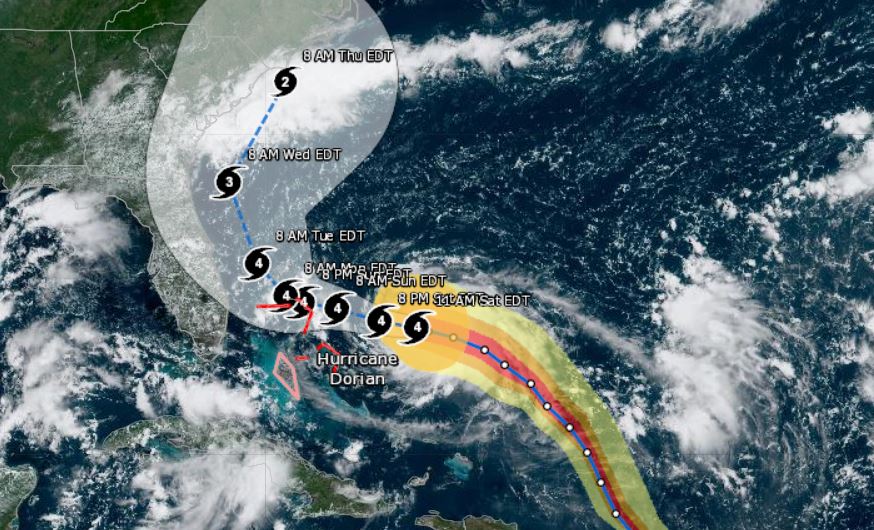
Hurricane Dorian is wide and slow-moving.
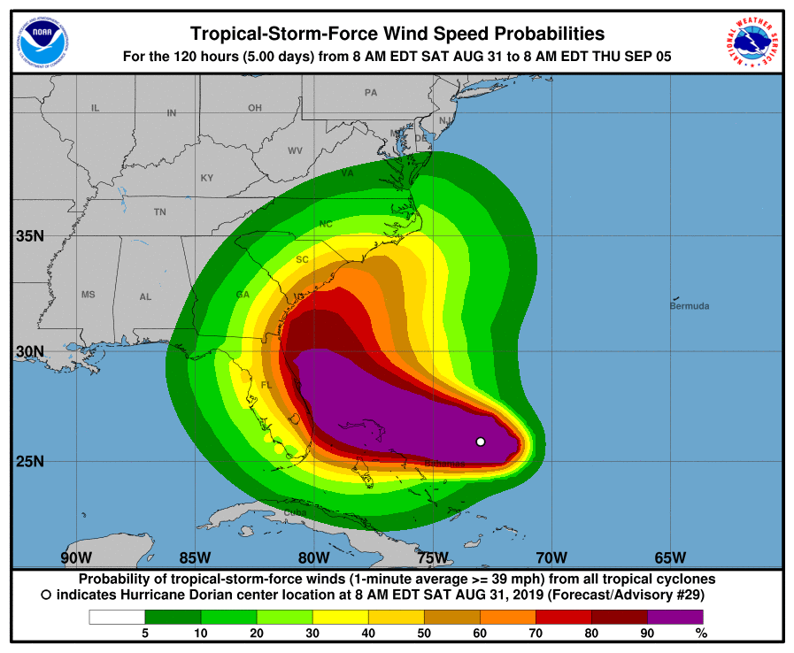
Mother nature is unpredictable, and with the path of the hurricane changing by the minute, there is a huge cone of uncertainty, the NOAA said. Even though the storm has shifted east, hurricane and tropical force winds are still a concern for Central Florida at this time. Additionally, in many areas, flooding is a concern.
The NHC says there is a possibility that if the hurricane continues to move as slow as it is while building strength, it could reach a category 5.
The NOAA urges that Floridians, particularly those along the coast, do not let their guard down.
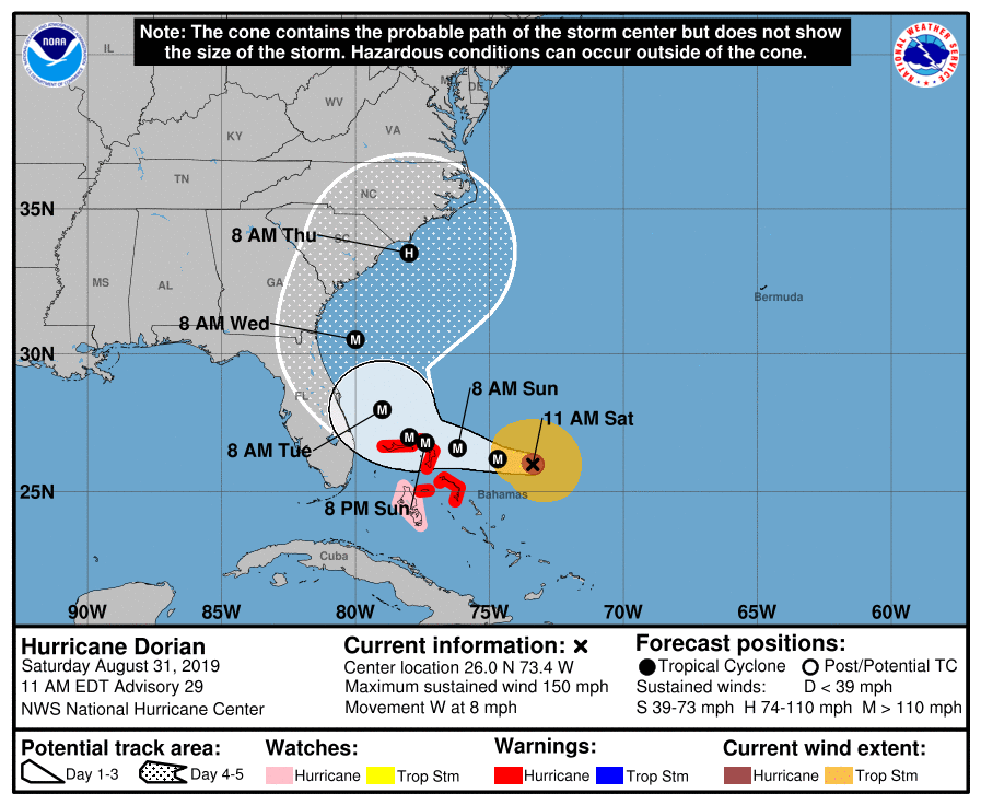
Hurricane Dorian is a powerhouse Category 4 hurricane that is a prolonged danger for parts of the Bahamas, Florida, Georgia, and the Carolinas well into next week.
Dorian’s center is about 280 miles east of the northwestern Bahamas. The hurricane is moving toward the west at 10 to 15 mph.
A hurricane warning is in effect for much of the northwestern Bahamas, including Freeport, Grand Bahama, and Nassau, New Providence Island. Andros Islands is in a hurricane watch.
Friday night, an NOAA Hurricane Hunter mission found Dorian had strengthened to a Category 4 hurricane. Dorian showed signs of “rapid intensification”, increasing from a Category 2 to Category 4 hurricane from Friday morning through Saturday morning.
A Saturday morning mission found that Dorin’s central pressure had dropped to 944 millibars, a 28 millibar drop in just 24 hours. Intense lightning was observed in the intense convection of the northern eyewall, which is a sign of the hurricane’s intensity.
Dorian does continue to shift away from the center of Florida, however, the bands are still riding along the coast at this time.